.jpg)
MACHICO
(Parish of Machico)
32° 43' 7" N 16° 45' 58" W
Machico (parish)
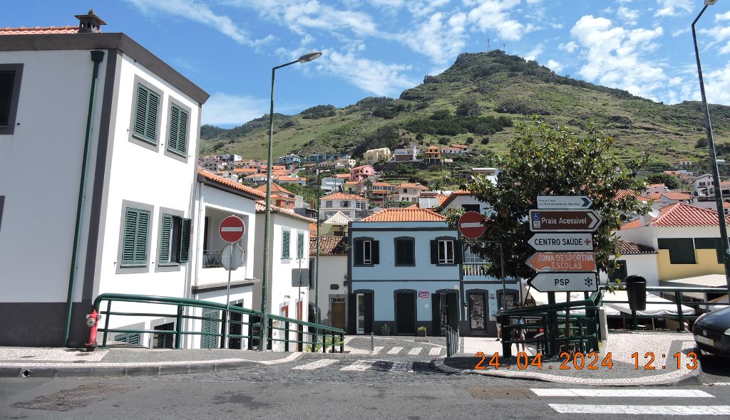
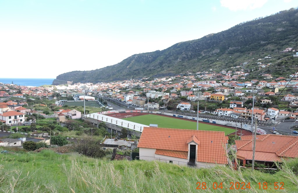
Machico is a Portuguese city and parish in the municipality of Machico, with an area of 17.49 km² and 9828 inhabitants (2021). Its population density is 561.9 inhabitants/km².
Built heritage
Chapel of Miracles or Chapel of Christ or Chapel of Mercy
(Capela dos Milagres ou Capela de Cristo ou Capela da Misericórdia);
Fort of São João Baptista da Madeira or Fort of Ancoradouro
(Forte de São João Baptista da Madeira ou Forte do Ancoradouro);
Machico Main Church (Igreja Matriz do Machico)
Fort of Our Lady of Amparo (Forte de Nossa Senhora do Amparo)
Chapel of São Roque (Capela de São Roque)
Solar do Ribeirinho
Machico Aqueduct (Aqueduto de Machico);


Fort of São João Batista (Machico)
32° 43′ 06″ N, 16° 45′ 31″ W
The Fort of São João Baptista, also referred to as Forte do Desembarcadouro, is located next to the pier in Machico, in the parish of Machico, municipality of Machico, on the island of Madeira. The São João Baptista Fort was built in the 18th century and was where the Portuguese disembarked, for the first time, to begin the settlement of the island of Madeira.
History
This fortification built in the 18th century is extremely important as it survived the destructive torrent of military constructions on the island. This Fort was built by governor Duarte Sodré Pereira in 1708. However, in 1695, the Embarcadouro Redoubt already existed where, in that year, Manuel Ferreira Maciel began his duties as constable.
In 1817, the artillery of the Fort of São João Baptista was in poor condition, as was the artillery of the Fort of Nossa Senhora do Amparo. Even so, on August 22, 1828, when the Miguelista fleet attempted to disembark in Machico, the three Village forts opened fire on ships entering the bay.
After the Miguelista attack, in 1863, the Fort was badly damaged and abandoned, which proved to be of practically no military use. However, the Fort still had other uses, such as as a hospital during the cholera epidemic at the end of the first decade of the 20th century. Later it hosted several holiday camps in the summer months, organized by the sisters of the Congregation of the Franciscan Missionaries of Mary, of the Convent of Santa Clara do Funchal. In order to establish itself as a Children's Bathing Colony, the District General Council carried out several adaptation works, including the construction of a dormitory and a chapel designed by the sculptor João Tomás Figueira da Silva (1920-2011).
Soon after the Carnation Revolution (1974), the Machico Popular Information Center founded a Kindergarten, which was closed in January 1976 by Brigadier Carlos de Azeredo. In September 1965, the Fort was occupied by refugees from the former Portuguese colonies in Africa. This opened a path for the recovery of this building classified as Cultural Heritage of the Autonomous Region of Madeira.
In 2002, the Regional Government approved a recovery program, which provided for museum and restaurant spaces. However, it was not implemented. In 2005, a new project emerged, signed by architect Victor Mestre, for a hotel unit with forty rooms, which would be executed by the company “Mare Nostrum”. The concession period, according to what was announced when the respective contract was signed with the Regional Government, was thirty years, but the project was not completed, even though, in 2008, the process of transferring the concession had been addressed. of the hotel restoration and operation work for another company. The construction of a WWTP in the protection area of the classified monument was, certainly, an obstacle to the continuation of investment in the Fort.
The city of Machico needs this space for its development and progress. The memory of the place also requires the preservation of its History. The rehabilitation of the 18th century fort would be one of the best ways to mark 600 years since the beginning of the settlement of Madeira, as it was there that the Portuguese landed, for the first time, in 1419.
In the context of the Portuguese Civil War (1828-1834), the liberal forces on the island fired fire from this fort against the Miguelista squadron. As the brig "Infante D. Sebastião" returned fire, the fort suffered slight damage (August 22, 1828).
In 1910, its premises were used as a choleric hospital, and wooden houses were built on its land for this purpose. Later it was used as a holiday camp for children from the Convent of Santa Clara do Funchal.
Characteristics
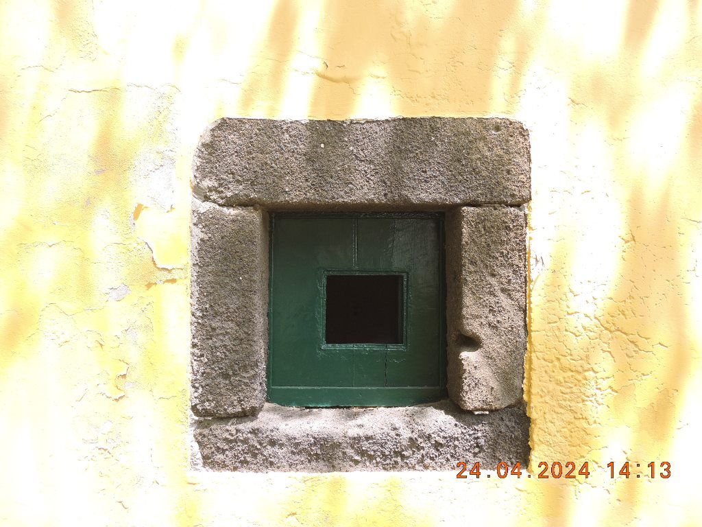
It is accessed by a raised stonework door and features a window with a red stonework frame and a green sunshade. It is covered by a masonry dome. The access staircase, which rises on the side, is made of dry stone and does not have a guard.
Inside, the neo-Gothic style chapel stands out, invoking the patron saint who gives the fortress its name.


Fort of Nossa Senhora do Amparo
32° 43′ 03″ N, 16° 45′ 54″ W
The Fort of Nossa Senhora do Amparo is located next to Passeio de Baixo in Machico, in the parish of Machico, municipality of Machico, on the island of Madeira, Autonomous Region of Madeira.
Its function was to defend that anchorage against attacks by pirates and privateers.
History
It was built in 1706, at the expense of Captain Francisco Dias Franco, clerk of the Chamber of Machico, according to the epigraphic inscription on the coat of arms.
In the context of the Portuguese Civil War (1828-1834), on the occasion of the disembarkation of Miguelist troops who aimed to eradicate the Liberal Regime in Madeira in 1828, it was the last fort on the island to capitulate.
With the proclamation of the Portuguese Republic (1910) the Crown, on the Armas stone above the fort's Gate, was removed.
In 1940 the property was handed over to the Fiscal Guard and in 1993 it was donated to the Regional Government of Madeira.
Currently redeveloped, it is the headquarters of the Machico tourist office.
Characteristics
The fort has a triangular shape, with one of its angles facing the sea. On the side facing the land, there is the arms gate, made of solid stonework with a round arch, surmounted by a baroque pediment. A tombstone with an epigraphic inscription marking the foundation of the fort is inscribed on this pediment, surmounted by the national coat of arms. Through it you access a tunnel with an island stone staircase that communicates with the embankment, partially landscaped and paved with pebbles, decorated with iron artillery pieces. The walls are topped with merlons with a projecting cord.
The service buildings are twins, with a rectangular plan with horizontal volumes, almost attached to the wall facing the land. Its facades face the sea, with doors and windows with stonework frames and a roof made of single-pitched Portuguese straw tiles.


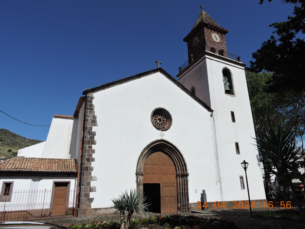
MACHICO MAIN CHURCH
32° 43′ 08″ N, 16° 45′ 58″ W
The main church of Machico, whose patron saint is Nossa Senhora da Conceição, was built in the first quarter of the 15th century. In 1460 it was already a parish church, with its first pastor being João Garcia. The people say that the Machico church is beginning to be built by the will of the people and its donee captain. Therefore, it does not bear the coat of arms of the crown, as appears in older churches.
In 1485 it is said that D. Manuel I, still Duke of Beja, donated three white marble columns to this church, placed in the side portico (Porta da Travessa). Tradition also says that D. Manuel I offered the image of the “Immaculate Conception”, known as the “Virgin of D. Manuel” from a Flemish workshop, today in the Museum of Sacred Art in Funchal.
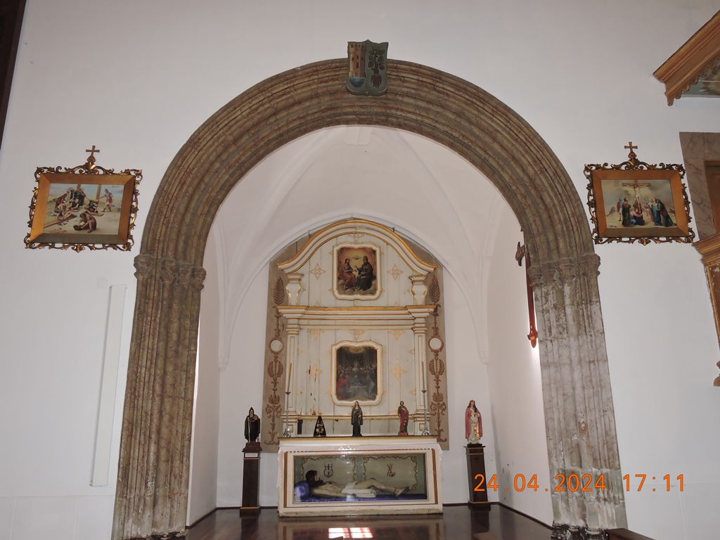
· The church has three interior chapels. The oldest will be of S. João Batista, ordered to be built by Tristão Vaz Teixeira, the 2nd donee captain of Machico, known as the “Tristão das Damas”, in the year 1496. There is the chapel of the Three Kings, ordered to be built by the daughter of the 1st donee captain, D. Branca Teixeira, at the end of the 15th century. This chapel had an altarpiece representing the “Adoration of the Magi”, dating from the 16th century, now in the Sacred Art Museum in Funchal. It was also the Chapel of S. Sacramento until the forties of the 20th century. We can still see remains of the dividing door and Eucharistic symbols on the altar. Under the floor of this chapel are remains of standard polychrome tiles from the 17th century. Another chapel is Espírito Santo, built by Sebastião de Morais in the mid-16th century. He has two oil paintings on wood, “Holy Trinity” and “Pentecost”. There was also an oil painting on wood of the “Last Supper” on the altar of this chapel, but it is now in the parish registry office. All of them are dated 1550 and attributed to Diogo de Contreiras. There is also the altar of S. Francisco Xavier, established by Canon Manuel Pereira de Castro, parish priest of Machico, in 1715.
· On the side of the ambo we have the collateral altar of the Heart of Jesus, with in two niches a wooden image of St. Joseph from the 17th or 18th century and an image of the Heart of Mary and on the altar is the image of St. Francis of Assisi . On the opposite side there is a painting on canvas “As Almas do Purgatório”, an image of Our Lady of Mount Carmel and Our Lady of Fátima and Saint Anthony of Lisbon.
· In 1747 the main church of Machico was compared to the Cathedral of Funchal for its grandeur and quality. In fact, the altarpiece, the chair and the organ give it a grand grandeur. The altarpiece of the main altar in gilt carved work between 1675 and 1698. In the center there is a tondo with the Holy Trinity in polychrome relief. It presents four niches like the four evangelists with their tetramorphic symbols. The carvings and sculptures are attributed to the Madeiran Manuel Pereira or his nephew Manuel Pereira de Almeida. On the main altar is the 17th century gilded tabernacle. At the entrance to the dressing room there is an image of the Immaculate Conception, in upholstered, polychrome and gilded wood, from the 17th century. In the dressing room there is a Eucharistic throne with five steps in a pyramidal shape made of gilded and polychrome carvings from the 18th century. In the main chapel there is a chair made of dark wood and finished with gilded carvings, with a painting of the twelve Apostles on the backrests, dating from the 18th century or early 19th century.
· In the sacristy we can see ashlars of polychrome tiles from the 16th century, with a camellia pattern, very rare in Madeira.
· At the main entrance of the church we can see six stone tombstones, five with inscriptions, identifying wealthy people from Machico and another piece that attests to the reuse of this material and which was transferred here during some works that took place in the 18th century and XIX. At the entrance to the side door we can also see another remains of tombstone.
· On the left wall of the church entrance there is a painting on canvas from a regional workshop from the 18th century presenting the “Tree of Jessé”: it is the largest canvas existing on this Island of Madeira.
· On the south facade of the church is the chapel of Nossa Senhora do Terço, where the Machico Treasury Room is located today. It was built by the people in 1770.
· The main church of Machico is rich in artistic and catechetical heritage in a city located by the sea where mass was celebrated for the first time in this pearl of the Atlantic, on July 2, 1419.


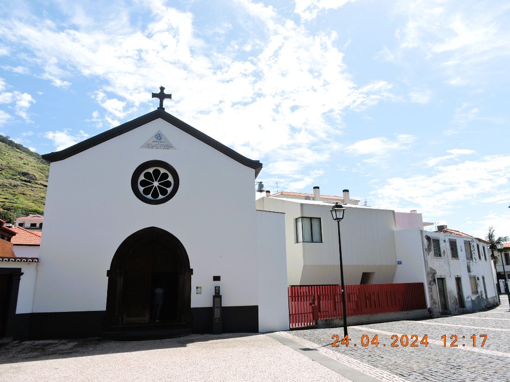
Miracles Chapel
(Capela dos Milagres)
32° 43′ 09″ N, 16° 45′ 51″ W
The History of the island of Madeira is deeply marked by the spiritual life of its people. The Miracles Chapel keeps the memory of one of the most symbolic moments of that history, as was built on the site where the first mass was held in Madeira, on the day after the discovery of the island, in 1419.
Located in Largo do Senhor dos Milagres, in Machico, this is a vernacular-architecture religious temple with Baroque features. It was built on the site where the Cristo Chapel (or Mercy Chapel) once stood, after it was destroyed in 1803 following a flood that affected the region.
We can still find several stones of the pointed-arch portico of the original building. The remaining are Neomanueline replicas. On the other hand, inside the Miracles Chapel we can find an image of crucified Christ that, after being washed out to sea by the flood, was 'miraculously' recovered three days later.
The flood of 1803 is annually remembered during a procession that receives thousands of pilgrims who come here to fulfil their promises. For this reason, the Milagres Chapel, on Madeira's east coast, has an invaluable historical and symbolic value.


Capela de São Roque
(São Roque Chapel)
32° 42′ 52″ N, 16° 45′ 52″ W
Commissioned by the second donee captain of Machico, Tristão Vaz Teixeira, following a promise, the history of São Roque Chapel takes us back to the distant year 1489. After going through several centuries of transformations and reconstructions, this small religious temple continues to take up a prominent position in the municipality's heritage.
This chapel is located on the western side of Machico bay. When it was built, São Roque Chapel was dedicated to Saint Roch, usually invoked against the plague and other diseases, as a token of gratitude for the end of the plague epidemic that was ravaging the region at the time.
However, the current São Roque Chapel dates back to 1739. This is because the previous building was demolished, given its run-down state. From that first temple, we can still find 17th-century tiles known as 'tapete de maçaroca' on the sacristy wall.
The temple we see today, built in plastered and whitewashed basalt masonry, has a longitudinal plan. The regional stonework portico has Baroque features. On the other hand, inside we highlight the valuable blue and white 18th-century tiles depicting the life of Saint Roch. The painting and the altarpiece are also Baroque.
Details
São Roque Chapel, built in 1489 and rebuilt in 1739, has several Baroque architectural elements. It takes up a prominent position in Machico's religious heritage.


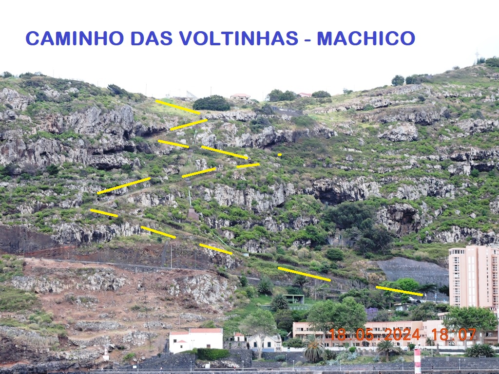
Caminho das Voltinhas
(Machico to Água de Pena)
32.714114,-16.765842
It is the emblematic section of the old Caminho Real no. 23, today known as Caminho das Voltinhas, which connects Água de Pena to Machico.
Highly recommended, it allows a simple, quick and risk-free pedestrian connection between Machico and a fantastic viewpoint already located in the parish of Água de Pena. The landscapes along the short route are stunning.
This route, with curves, was a main connection for centuries. Therefore, it is easy to remember all those who walked it on foot.


Banda D'Além Beach
(Praia da Banda D'Além)
32.718548, -16.762224
The bay of the city of Machico gives the city an incomparable elegance: the calm and crystal-clear sea that bathes this area blends with the green mountains that surround it. It is precisely in this scenery that you can find Banda d'Além Beach.
This bathing area is a great option to enjoy a pleasant and relaxing day with family or friends. Located on the right bank of the mouth of Ribeira de Machico, it is about 70 metres long and 100 metres wide.
Banda D'Além Beach stands out among the traditional Madeiran pebble beach resorts thanks to its golden sand, imported from Morocco. It is one of the few of its kind on the island, and became one of the most popular recreational areas for locals and visitors alike.
This beach has a lifeguard during the bathing season and a series of facilities to support bathers. It has cabins for changing clothes, showers, toilets, a parking area, access walkways and conditions for people with reduced mobility. At Banda d'Além Beach you can also find several leisure and sports equipment.
Details
Banda d'Além Beach, with golden sand from Morocco, is located in Machico bay. With a series of support facilities, it offers all the necessary comfort conditions.


São Roque Beach
(Praia de São Roque)
32.716909, -16.764271
With its pleasant and peaceful atmosphere, São Roque Beach takes up a large portion of the emblematic Machico bay. This is one of the most popular recreational areas among holidaymakers in the region.
Located between the mouth of Ribeira de Machico and São Roque Chapel, built in 1489 by Tristão Vaz Teixeira, this beach offers all the necessary conditions for a relaxing day by the sea. It has the typical pebbles that can be found on most of Madeira's beaches.
Furthermore, São Roque Beach, which is freely accessible, has various facilities to ensure the safety and comfort of bathers. Users will find toilets, showers, a first-aid station, an area with parasols, and also an area with restaurants and bars nearby. During the bathing season, this beach is supervised by lifeguards.
To park your car, we recommend using the car park of Fórum Machico, located nearby. You will find all the necessary conditions to enjoy a pleasant and peaceful bathing experience at São Roque Beach, with the undeniable elegance that characterises the city of Machico as a backdrop.
Details
São Roque Beach, a pebble beach, takes up a large portion of Machico bay. It is equipped with various support facilities, ensuring a comfortable and pleasant bathing experience.


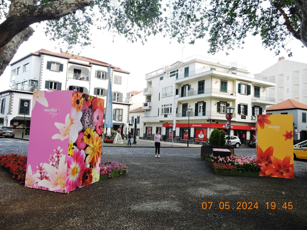
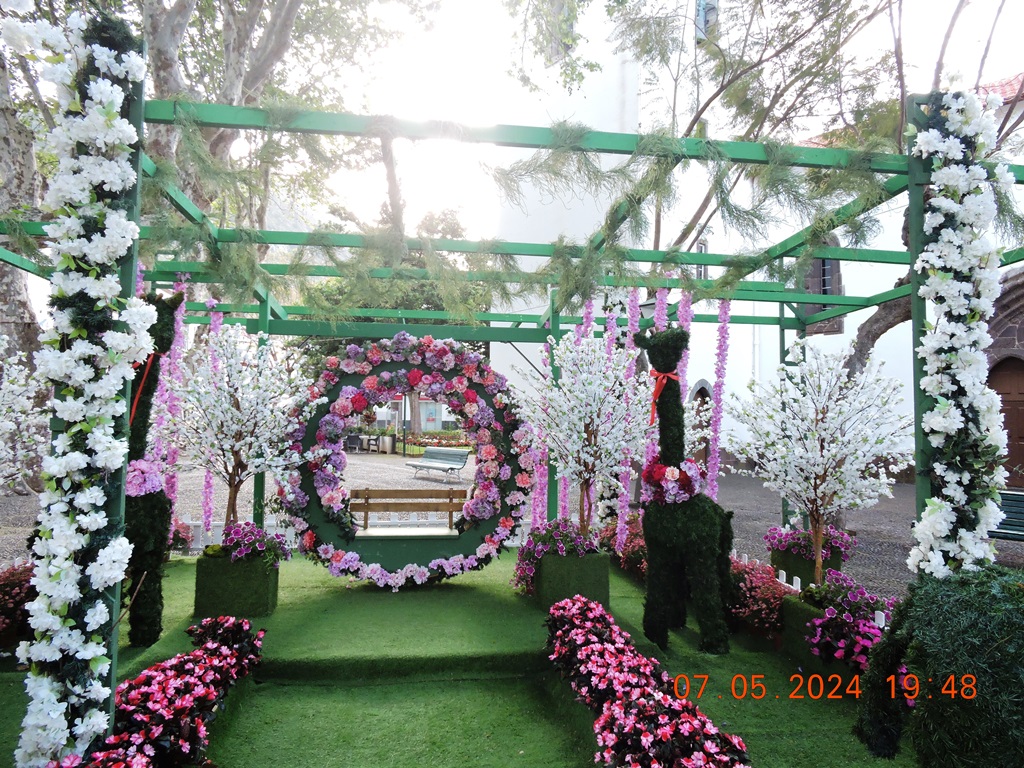
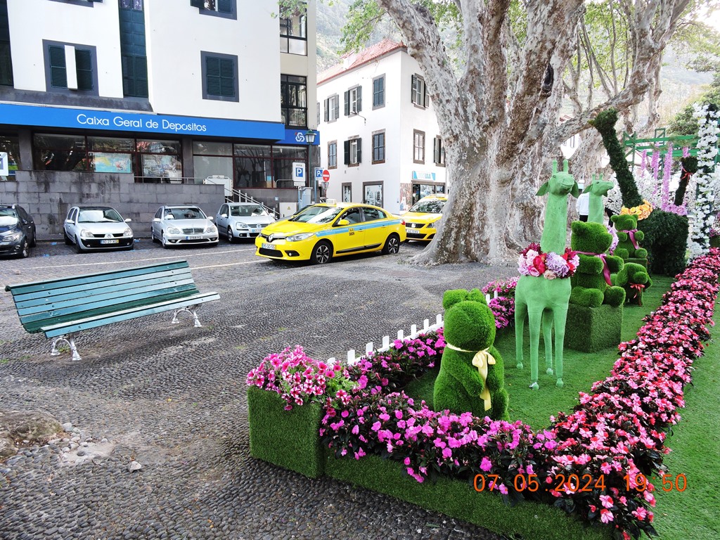
FLOWER FESTIVAL
With the arrival of spring, Madeira's gardens become even more colourful and exuberant. This festival celebrates the vitality of Nature.
This festival, which brings the color of flowers to the main places on Madeira Island, takes place during the month of May.


👇👇👇👇👇


Solar do Ribeirinho Museum
32.718471, -16.767265
Located in the city centre of Machico, the Solar do Ribeirinho Museum presents visitors with a rich collection of the main figures and most important moments in the history of the municipality.
This museum is housed in a historic building dating from the 17th century called 'Solar do Ribeirinho', which underwent a renovation process that allowed housing this cultural institution. The Solar do Ribeirinho Museum provides interactive teaching and educational resources using new information technologies.
The permanent exhibition consists of four theme-based areas, where various historical objects can be found. Among them, we can highlight: a cross from Machim; a portrait of Tristão Vaz Teixeira, the first Captain-Donee of Machico; a processional cross from the 17th century; a century seal with an ivory handle and silver stamp from the 16th century; an inscription engraved with a poem by 18th-century poet Francisco Álvares de Nóbrega (Camões Pequeno - Little Camões), born in the locality.
In addition, the Solar do Ribeirinho Museum has several relevant archaeological objects, made of ceramics, stone or metal, and also a series of pieces that mirror the economic, social and cultural history of Machico, from the 15th century to the 20th century.
Details
The Solar do Ribeirinho Museum has a diverse collection of objects that reflect the economic, social and cultural history of Machico, from the 15th to the 20th century.
Lift; access ramps and adapted bathrooms.


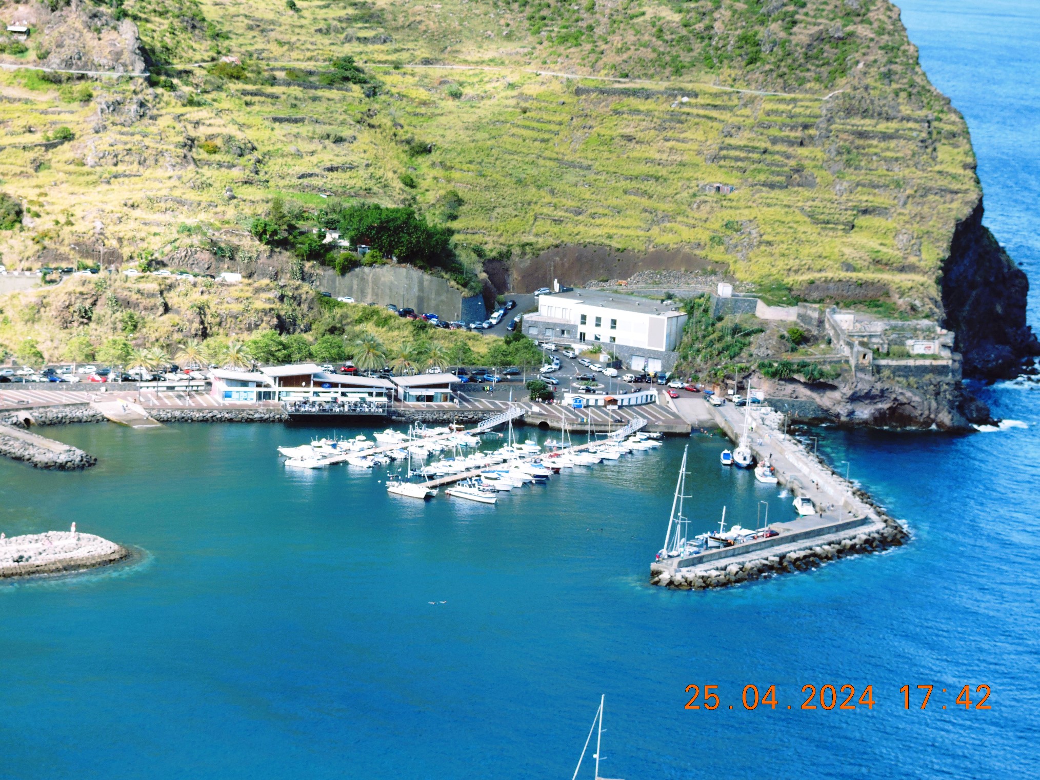
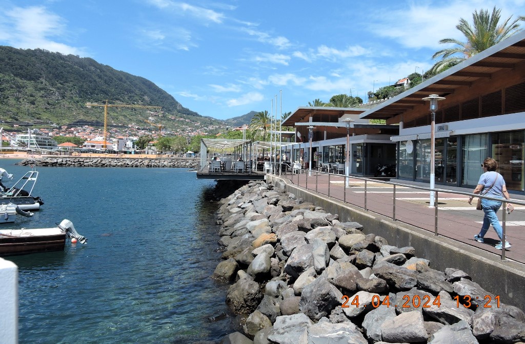
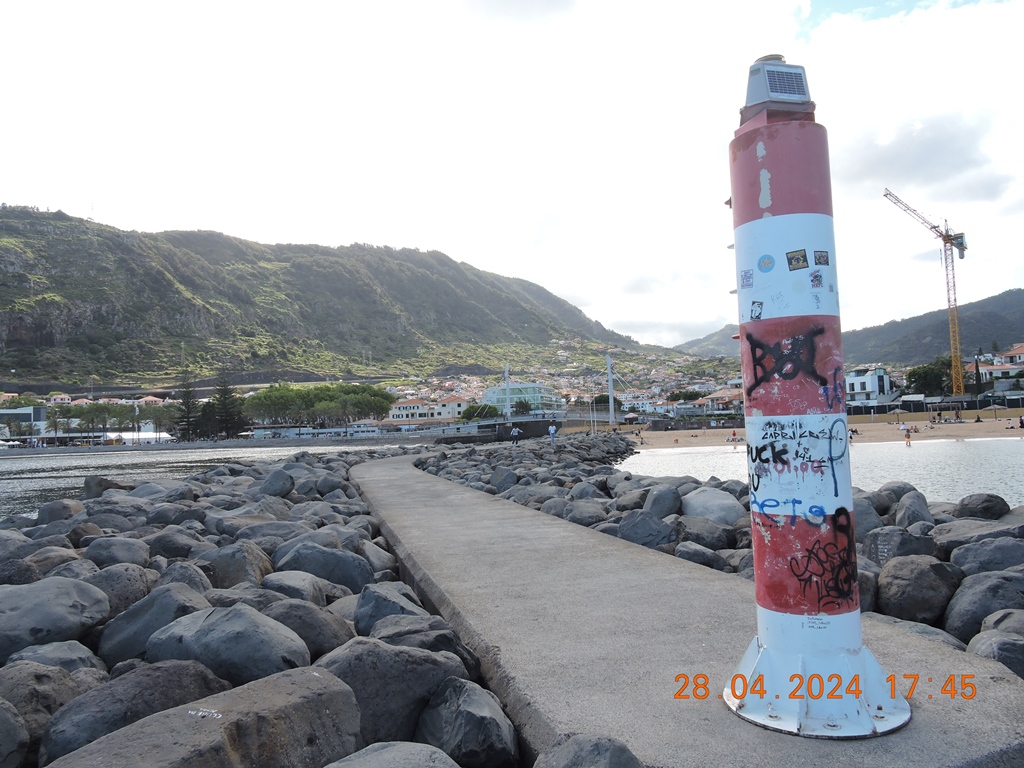
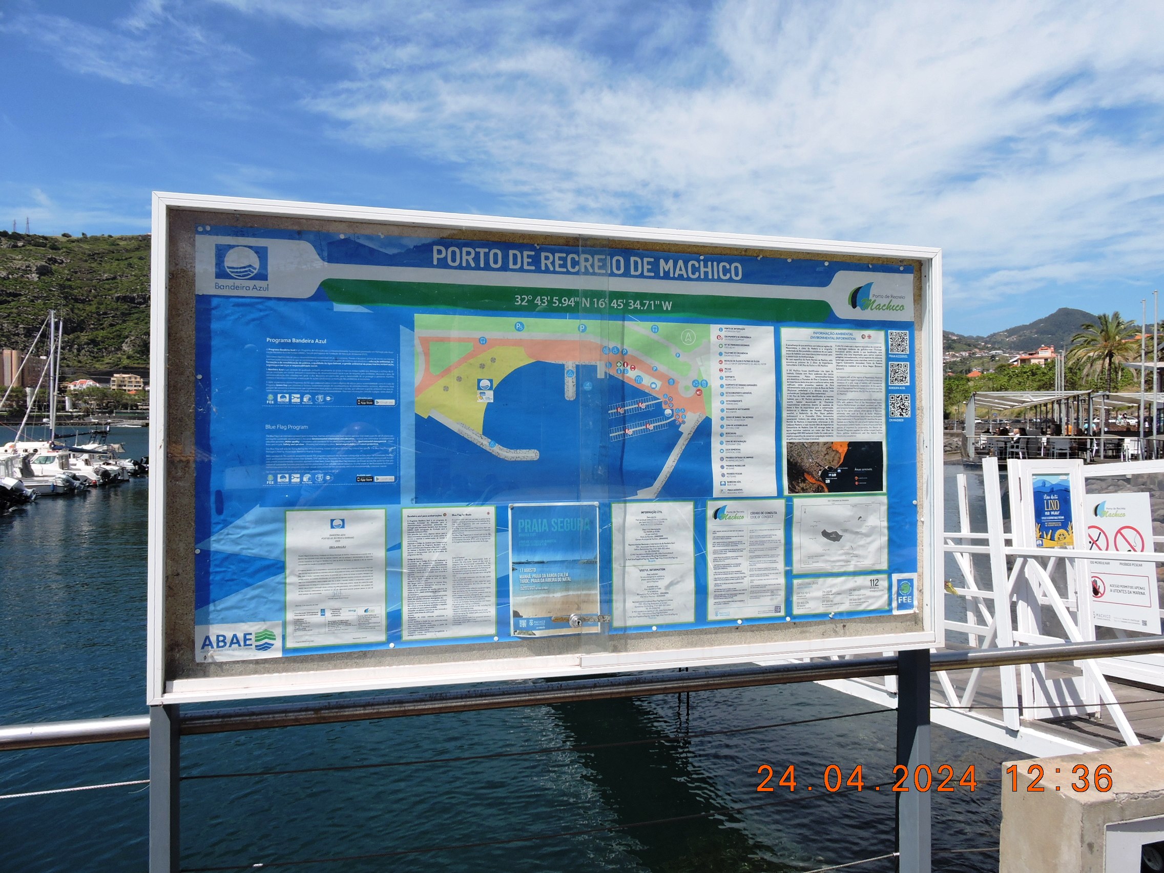
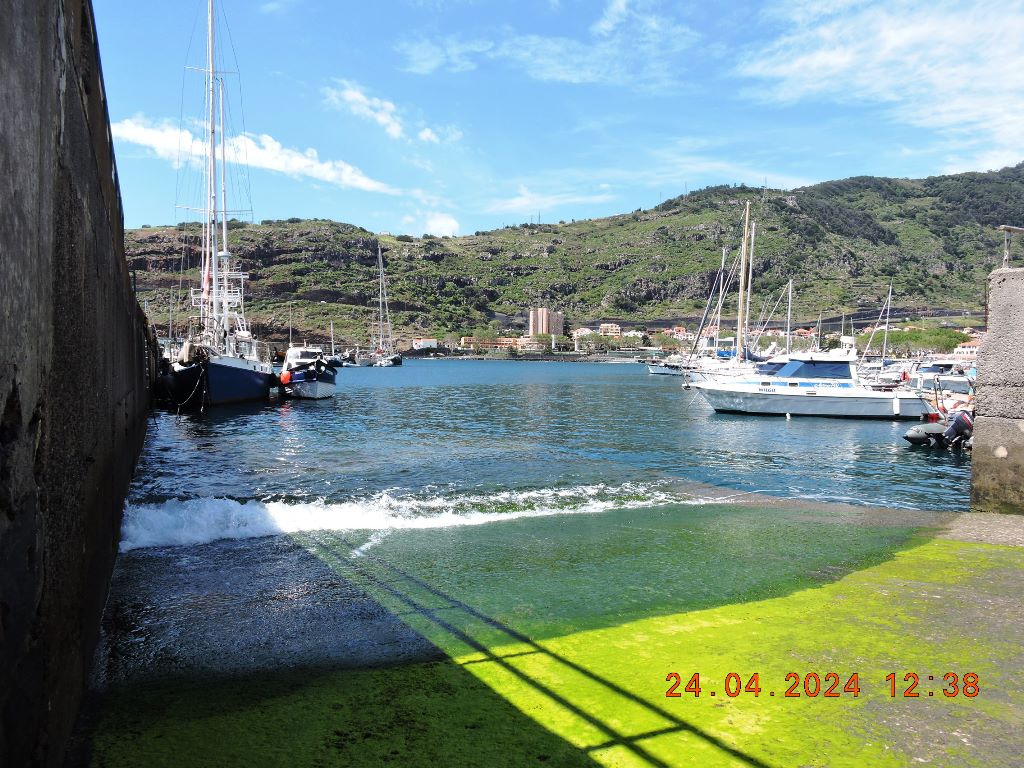
Port of Machico
(Calheta Recreational Port)
32.717306, -16.759866
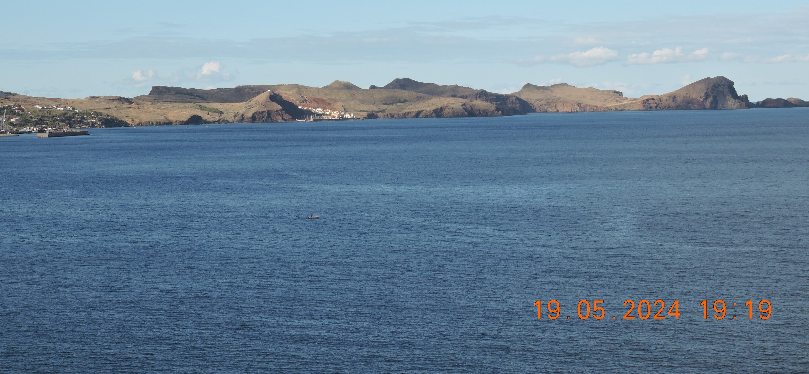
Machico Bay is of inestimable historical value. Remember that it was here that Portuguese navigators first landed on the island of Madeira in 1419. Thus, more than 600 years later, the city of Machico continues to be an important point for nautical activity.
As such, the Port of Machico is one of the most important ports on the east coast of Madeira, with capacity for 80 small and medium boats up to twelve tons.
Here, boat owners can enjoy water and electricity supply on both pontoons, have access to general waste and recycling containers, including one for oil and batteries.
Next to Port of Machico there is a pleasant promenade that leads to the artificial sandy beach, and further on to the pebble beach - S. Roque Beach. In 2022, Port of Machico was awarded the Blue Flag for the first time.
Details
The Port of Machico, located east of Funchal, can accommodate up to 80 boats and was awarded the Blue Flag in 2022.


MIUT – Madeira Island Ultra Trail
MIUT – Madeira Island Ultra Trail is one of the best ultras in the world. Sometimes sunny and warm, occasionally rainy, cold, and cruel with runners.
MIUT® is a annual trail running event that ran across the island, from sea to sea, in the Northwest-Southeast direction, starting in Porto Moniz, at sea level, passing through the highest points of the island, and arriving, again, at sea level, in Machico.
The 15th edition of the Madeira Island Ultra-Trail was a true success and deserved praise from everyone, especially the athletes. Many promise to return and guarantee that they will be in Madeira next year, in April, for the 16th edition. MIUT is one of the founding events of the World Trail Majors, the new global trail running circuit. This year's edition, 2024, featured two records, one in the 85 km race, the other in the 16 km.
Numbers and curiosities for the 2024 edition
The 2024 edition had a record number of registered athletes: 3,481 in total, 2,300 of which were foreigners. 58 nationalities were represented at MIUT. France, with 1,192 athletes, was the most represented country, followed by Portugal (1,003). In the 115 km race, the longest at MIUT, the best Portuguese was Nélson Santos, an athlete from Runners do Demo, 4th overall, who completed the race in 14:51:20 hours.
Registered per race in 2024: MIUT'115 km (1,051 athletes), MIUT'85 km (526 athletes), MIUT'60 km (547 athletes), MIUT'42 km (834 athletes) and MIUT'16 km (523 athletes) .
The MIUT's flagship race, 115 km, once again crossed the island of Madeira in a northwest-southeast direction, starting in Porto Moniz, at sea level, passing through the highest points of the island, and then returning again at sea level for the target installed in Machico.
The 15th edition of MIUT had 850 volunteers, distributed across various tasks, such as cleaning paths, gas stations (there are 13 stations), security, appointments, secretariat, as well as a time system, communication and other essential aspects for the unfolding of the Madeira Island Ultra-Trail.
Two records give even greater shine to MIUT


LEVADA WALKS
Levada do Caniçal
32.732965, -16.764755
About the walk...
Surrounded by stunning views of the unique parish of Caniçal, Levada do Caniçal is a one-way walk that takes hikers on a peaceful stroll along the canal.
The 4-kilometre-long levada has two different starting points, one at ER 214 next to the Caniçal tunnel or on ER 109 next to the Caniçal cemetery.
Due to the length and tranquillity of the route, most hikers choose to make the round trip starting at the Caniçal tunnel at ER 214.
Built to irrigate the crops grown in the small parish, the water in the usually active levada flows East towards Ponta de São Lourenço.
Levada do Caniçal is the perfect choice for those who like to admire profound landscapes and come into close contact with the regions they visit. This hike provides you with excellent views over the village and the Madeira Free Trade Zone. The International Business Centre of Madeira, also known as the Madeira Free Trade Zone is an exclusive financial development centre that benefits from its own tax regime that has contributed to the growth of Madeira as a European reference for foreign investment.
Caniçal officially became a village in 1994 and is a fishing village by nature. Caniçal has always had very strong connections to the sea, this connection is apparent at many levels, from the main cargo port on the Island to the docks.
For one-way walks (keeping in mind that you can turn back to your starting point if needed) we recommend you go with a tour operator or hire a transport service to get back to your point of origin. Search the business directory and look for companies that provide these services.


1- Levada do Caniçal - Boca do Risco
32.73281359867655, -16.76473098433327 »»»
»»»» 32.75547392046421, -16.77265819654209
Distance: 12 km
Duration: 3-5 hours
Start/End: Machico/Machico
Min/max altitude: 220/500 m
This route combines the cultures and traditions of Madeira Island with a mix of sea and mountain landscapes.
Starting next to the tunnel on the old road that connects Machico to Caniçal, this route offers hikers a unique experience that allows them to unleash their spirit of adventure and discovery.
Along the way, incredible views of the city of Machico emerge, with its houses and buildings set against the backdrop of the vast Atlantic Ocean.
Go up the Vereda da Boca do Risco which will take you to the viewpoint that offers a wonderful view of the north coast of the Island. Enjoy the surroundings and the scenic beauty of this spot.


2 - Levada do Caniçal - Pico do Facho
32.73292143200935, -16.764741429172 »»
»» 32.723981668718686, -16.758694941316865
About the walk...
Surrounded by stunning views of the unique parish of Caniçal, Levada do Caniçal is a one-way walk that takes hikers on a peaceful stroll along the canal.
The 4-kilometre-long levada has two different starting points, one at ER 214 next to the Caniçal tunnel or on ER 109 next to the Caniçal cemetery.
Due to the length and tranquillity of the route, most hikers choose to make the round trip starting at the Caniçal tunnel at ER 214.
Built to irrigate the crops grown in the small parish, the water in the usually active levada flows East towards Ponta de São Lourenço.
Levada do Caniçal is the perfect choice for those who like to admire profound landscapes and come into close contact with the regions they visit. This hike provides you with excellent views over the village and the Madeira Free Trade Zone. The International Business Centre of Madeira, also known as the Madeira Free Trade Zone is an exclusive financial development center that benefits from its own tax regime that has contributed to the growth of Madeira as a European reference for foreign investment.
Caniçal officially became a village in 1994 and is a fishing village by nature. Caniçal has always had very strong connections to the sea, this connection is apparent at many levels, from the main cargo port on the Island to the docks.
For one-way walks (keeping in mind that you can turn back to your starting point if needed) we recommend you go with a tour operator or hire a transport service to get back to your point of origin. Search the business directory and look for companies that provide these services.


Vereda da Boca do Risco to Caniçal
32.752516, -16.769867 »»»»»
»»»»» 32.739088, -16.738281

About the walk...
Vereda da Boca do Risco to Caniçal is a spectacular trail that combines the rural atmosphere with exotic landscapes. Surrounded by diverse flora, the walk takes you on an idyllic route that presents you with the coastal scenery of Madeira.
The starting point of this walk is located at the "Casa dos Levadeiros", where you will find Levada dos Maroços. The canal leads you through rural surroundings, where small plots of land planted with various fruits and vegetables grow side by side with exotic forests.
The tranquil scenery of Levada dos Maroços is defined by the traditional terraced farmland known as “poios”. Look out for the signpost saying "Vereda da Boca do Risco" and follow the path to the right, leaving the Levada behind. This path, the Vereda da Boca do Risco, takes you through the rolling hills of the pretty Ribeira Seca Valley. After a short hike you will arrive at Boca do Risco, one of the most beautiful natural viewpoints on the East side of the Island and the highlight of the walk.
Some hikers end their walk at the viewpoint, where they can contemplate the rugged landscape as well as the Atlantic Ocean.
Back on the main track heading east, the route leads to Caniçal. Only experienced hikers should attempt this route as a way of maintaining personal safety.
The walk unfolds along a natural and authentic track with impressive views of the coast.The majestic coastal scenery continues throughout the walk. As the trail approaches Caniçal, the geological differences are visible in the landscape. There are many geological curiosities to encounter during the final part of the walk, as well as Levada do Caniçal at about 100 meters altitude.
The trail ends at Rua das Feiteirinhas, near the Caniçal Cemetery.
To do this walk, it is recommended you hire the services of a tour operator and enjoy the walk with a guide. If you prefer to go unaccompanied, hire a local transport service to get back to your point of origin. Search the business directory and look for companies that provide these services.


Levada dos Maroços (Ribeira Seca - Machico)
32.73504679811244, -16.804044618964465
About the walk...
Levada dos Maroços flows almost entirely in Machico. Yet, the canal starts in the parish of Santo António da Serra and finishes in Caniçal.
This walk allows you to discover the interior of the parish and is an excellent example of life on the rural outskirts of Machico.
The rural landscape is reflected in the traditional terracing, known as poios. Working against the mountainous landscape, the Madeirans shaped the land through arduous work.
Levada dos Maroços is a long but pleasant walk that is relatively flat. This levada does not present any significant difficulties.
Due to the slow-paced nature, this walk is popular among families that find in Levada dos Maroços an urban walk within a rural context. This Levada has many access points that ease the logistics of the long hike.
There are connections to other paths along the levada, namely to Vereda das Funduras, Vereda da Boca do Risco and Vereda do Pico Castanho.
Built to irrigate the surrounding farmland, the levada collects water from various streams and tributaries that intersect with it.
The route finishes at the Caniçal Tunnel at ER 214. It is recommended you go with a tour operator in the company of a guide or hire a local transport service to get back to your point of origin. Search the business directory and look for companies that provide these services.


Veredas da Boca do Risco e Larano
About the walk...
Vereda da Boca do Risco to Larano is a spectacular trail that combines the rural atmosphere with exotic landscapes. Surrounded by diverse flora, the walk takes you on an idyllic route that presents you with the coastal scenery of Madeira.
The starting point of this walk is located at the "Casa dos Levadeiros", where you will find Levada dos Maroços. The canal leads you through rural surroundings, where small plots of land planted with various fruits and vegetables grow side by side with exotic forests.
The tranquil scenery of Levada dos Maroços is defined by the traditional terraced farmland known as “poios”. Look out for the signpost saying "Vereda da Boca do Risco" and follow the path to the right, leaving the Levada behind. This path, the Vereda da Boca do Risco, takes you through the rolling hills of the pretty Ribeira Seca Valley. After a short hike you will arrive at Boca do Risco, one of the most beautiful natural viewpoints on the East side of the Island and highlight of the walk.
Some hikers end their walk at the viewpoint, where they can contemplate the rugged landscape as well as the Atlantic Ocean.
To get to Larano, head back down to the main trail and head west.
Most coastal paths, such as this, were once used by locals to get from one village to another. Excavated from the cliff itself, these trails are vulnerable to erosion.
The path to Larano is visually stunning, but there are a few inherent risks that demand extra care, especially experience. Cables have been installed at some of the more eroded areas to aid in mobility.
At Larano, although exotic species replace the endemic vegetation the floral intensity remains. The path ends at Caminho do Cabo do Larano, where there is a small cable car.
From here you can continue down to the village of Porto da Cruz or hire specialised services. To do this walk, it is recommended you hire the services of a tour operator and enjoy the walk with a guide. If you prefer to go unaccompanied, hire a local transport service to get back to your point of origin. Search the business directory and lookup companies that provide these services.


Vereda do Larano
??????? »»»»»
»»» 32.755700, -16.772650
Total distance: 12 km
Time: 3-4 hours
Maximum altitude: 350 m
Minimum altitude: 10 m
Home: Machico
End: Porto da Cruz
Recommended: Appropriate footwear (boots) | Staff/Baton
Care to take:
Please avoid deviating from the main trail, to avoid damaging the local flora and fauna;
Don't get too close to the cliffs;
This route begins in Machico, next to the old tunnel that connects Machico to Caniçal, and guides walkers to Porto da Cruz, along a path that was once widely used by the population to travel between these two locations.
The beginning of the route is accessible to anyone, taking the levada which offers magnificent views over Machico until reaching the Miradouro da Boca do Risco, where walkers can enjoy a wonderful view over the north coast of the island.
From here, towards Porto da Cruz the route is very difficult. The path follows the hillside overlooking the vast Atlantic Ocean, on a narrow and unprotected path, which is why it is only recommended for experienced walkers.
Vereda das Funduras PR5 (Portela – Maroços)
32.747663, -16.825493


This 8.7 km trail, which takes about 3 hours, begins with a breathtaking view from the Portela Viewpoint over the parishes of Porto da Cruz and Faial on the northern coast of the island.
The landscape along Vereda das Funduras is, however, dominated by the imposing rocky outcrop of Penha d'Águia, one of the greatest geological symbols of Madeira.
A trail of moderate difficulty, Vereda das Funduras runs through the green hills of Machico towards Maroços.
Initially, the trail follows the Serra das Funduras forest road and then joins the footpath that plunges into the indigenous Laurissilva forest.
This site, included in the European Network of Sites of Community Importance - the Natura 2000 Network - plays a key role as the main support for the island's endemic fauna and flora.
During the walk, you will come across Casa das Funduras, which supports forestry activities.
There, you can choose to go to the Larano viewpoint and enjoy a wide view over the bay of the city of Machico.
Finally, Vereda das Funduras crosses the traditional terraced fields that characterize the agricultural landscape of Madeira and ends at Maroços.
Details
Distance: 8.7 km
Difficulty: Moderate
Duration: 3 hours
Start/End: Miradouro da Portela / Maroços
Max. Altitude / Min. Altitude: 624 m / 186 m

Total distance: 8.7 km
Time: 3-4 hours
Maximum altitude: 605 m
Minimum altitude: 175 m
Start: Portela Viewpoint
End: March
Recommended: Appropriate footwear (boots)
Care to be taken:
Please avoid deviating from the main trail, so as not to spoil the local flora and fauna;
Don't get too close to the cliffs;
This trail starts at the Portela viewpoint and ends at the Maroços site, with a length of 8.7 km and a duration of 3 hours. From this viewpoint, hikers have a magnificent view of the parishes of Porto da Cruz and Faial, dominated by the rocky mass of Penha d´Águia.
The route follows the forestry road of the Funduras mountain range, only then enters the trail through the interior of the Laurissilva forest, a little further on there is the “Casa das Funduras”, which supports forestry activities. There you can choose to go to the Larano viewpoint where you will have a beautiful view of the bay of the city of Machico.
💝💝💝💝💝
SEARCH IN
MACHICO MUNICIPALITY
Return to mainland Portugal and
to the Azores and Madeira islands


No comments:
Post a Comment